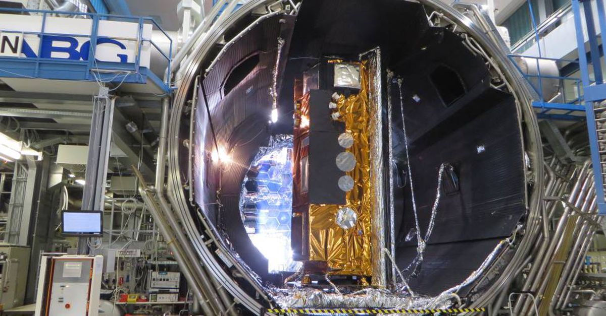
The Minister of Defence, Margarita Robles, will this Monday participate in the ceremony of the fifth anniversary of the PAZ satellite, the Spanish Earth observation satellite with radar technology, operated by Hisdesat.
As reported by the company, the Minister of Defense will put the final touches on the celebration of the five years of the life of the PAZ satellite, in an act which will be intervened by the Minister of Defense, María Amparo Valcarce.
The event, which will take place at Espacio Pablo VI in Madrid at 19.00, will begin with some welcoming words from Santiago Bolíbar, Chairman of Hisdesat’s Board of Directors. Subsequently, the Chief of the Defense Staff (Jemad), Admiral General Teodoro López Calderón, will officiate the act, and will be led by a speech by Miguel Ángel García Primo, CEO of Hisdesat. After a round table, the Secretary of State’s address and closing remarks by Margarita Robles, a cocktail will round off the day’s program.
Before that, guests will be able to learn about the main milestones in the success that Spain achieved thanks to Hisdesat with PAZ, the first Spanish Earth observation satellite with synthetic aperture radar (SAR) technology operated by Hisdesat company, which five years later Since its launch into orbit, it has captures 114,000 images for public or private institutions, operating for civilian and military environments.
The satellite has positioned Spain as one of the European leaders in aerospace technology, and after five years has established itself as a strategic tool, due to its dual nature, in both military and civilian applications.
PAZ has taken 60,000 images commissioned by the Ministry of Defense to meet its needs for military intelligence. In particular, it has functioned to support the missions of the Armed Forces abroad, control of borders or control of maritime movements within the framework of international defense operations.
In the civilian field, PAZ users have grown exponentially since the beginning of its operations thanks to the possibilities of its radar technology, which allows shooting both day and night, and regardless of weather conditions.
APPLICATION
To date, the satellite has provided 54,000 images, including those related to risk and emergency management, environmental surveillance, control of critical infrastructure and civil works or maritime surveillance.
On the other hand, it is used to assess the impact of the flooding that occurred in Alicante in 2019, in detecting an oil spill in the SAR zone of the Canary Islands or in a volcanic eruption on the island of La Palma. At this last point, it is very important to determine how the orography of the area changed and how the lava flows developed.
Abroad, it has been used to study Brazil’s deforestation, monitor nuclear power plants in various countries, or diagnose the effects of earthquakes in Turkey and Syria, among other disasters.
One of the advantages is that this satellite is the only one that offers real-time monitoring of world maritime traffic thanks to AIS (Automatic Identification System) technology combined with the main instrument of synthetic aperture radar (SAR).
During its five years of operation, it has served images to public and private users in more than 25 countries: United States, Canada, Italy, United Kingdom, Norway, Mexico, Chile, and South Africa are some of them.
In Spain, apart from providing services to the Ministry of Defence, he has provided drawings to the departments of Interior, Foreign Affairs, Transport and Treasury, as well as various regional organizations.

“Entrepreneur. Internet fanatic. Certified zombie scholar. Friendly troublemaker. Bacon expert.”


